Site Mapping & Planning
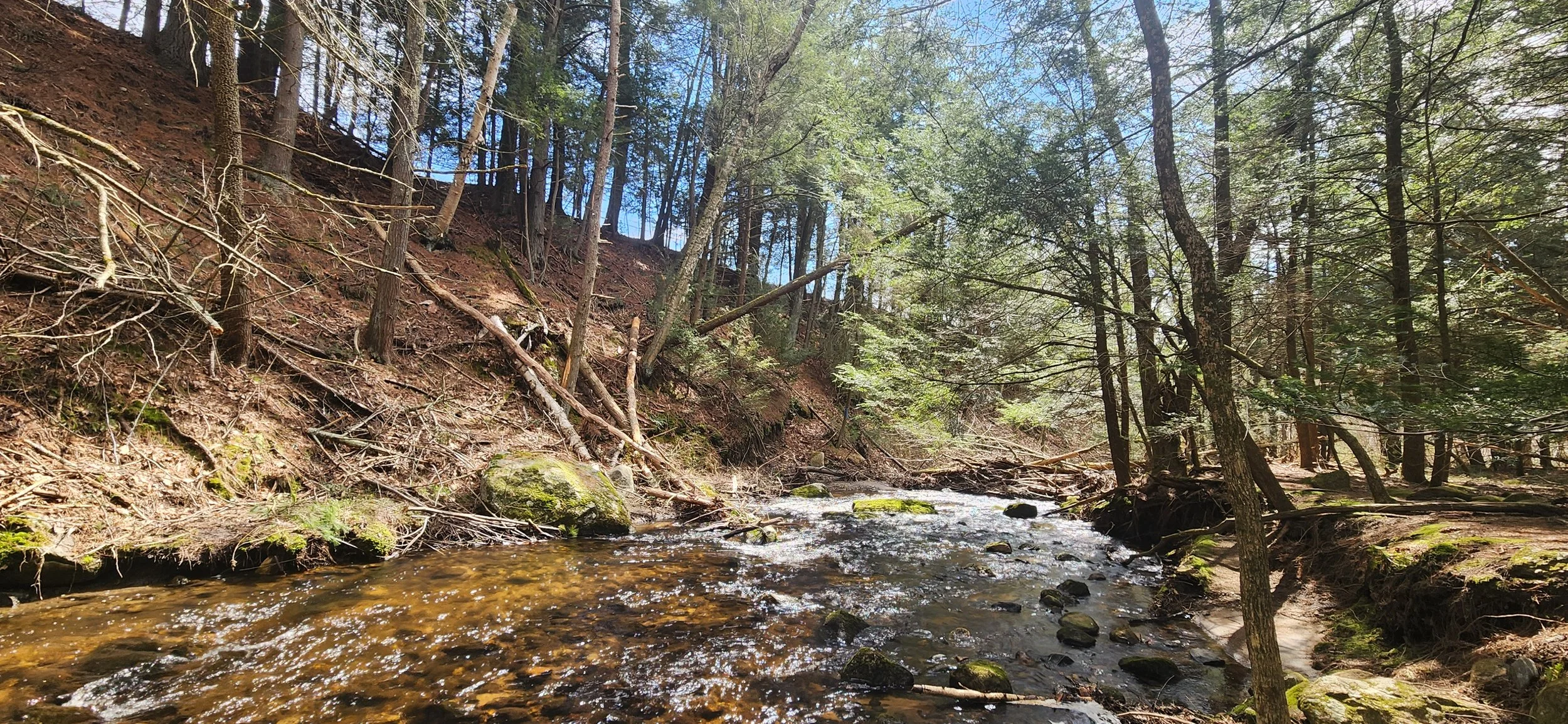
Capture the vital details of your landscape. Through rigorous on-site observation using advanced technology, we document existing conditions and understand the ecological systems and patterns affecting your project in order to guide holistic decision making.
Data Collection
Aligning Needs

Understanding Patterns
We utilize a combination of onsite observation, GPS surveying, drone mapping and GIS software to collect accurate data and create highly accurate and geo-referenced base maps.
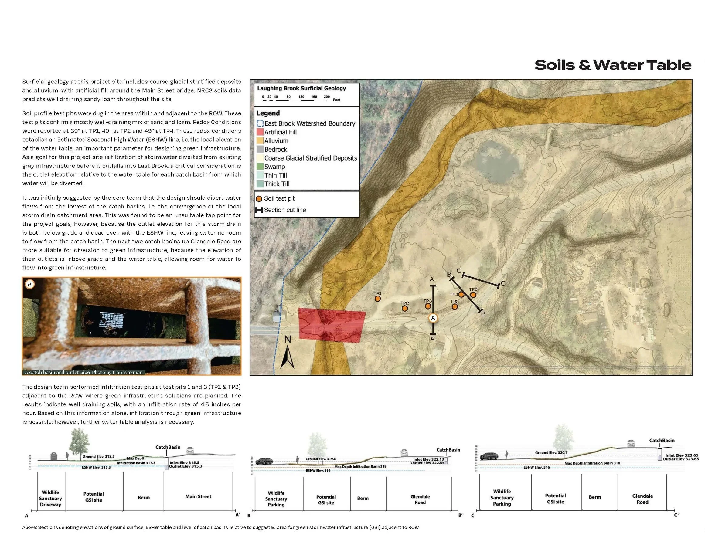
Through in-depth analysis of ecological, topographical, hydrological and climatic conditions, we are able to identify patterns, constraints and opportunities inherent in your project.
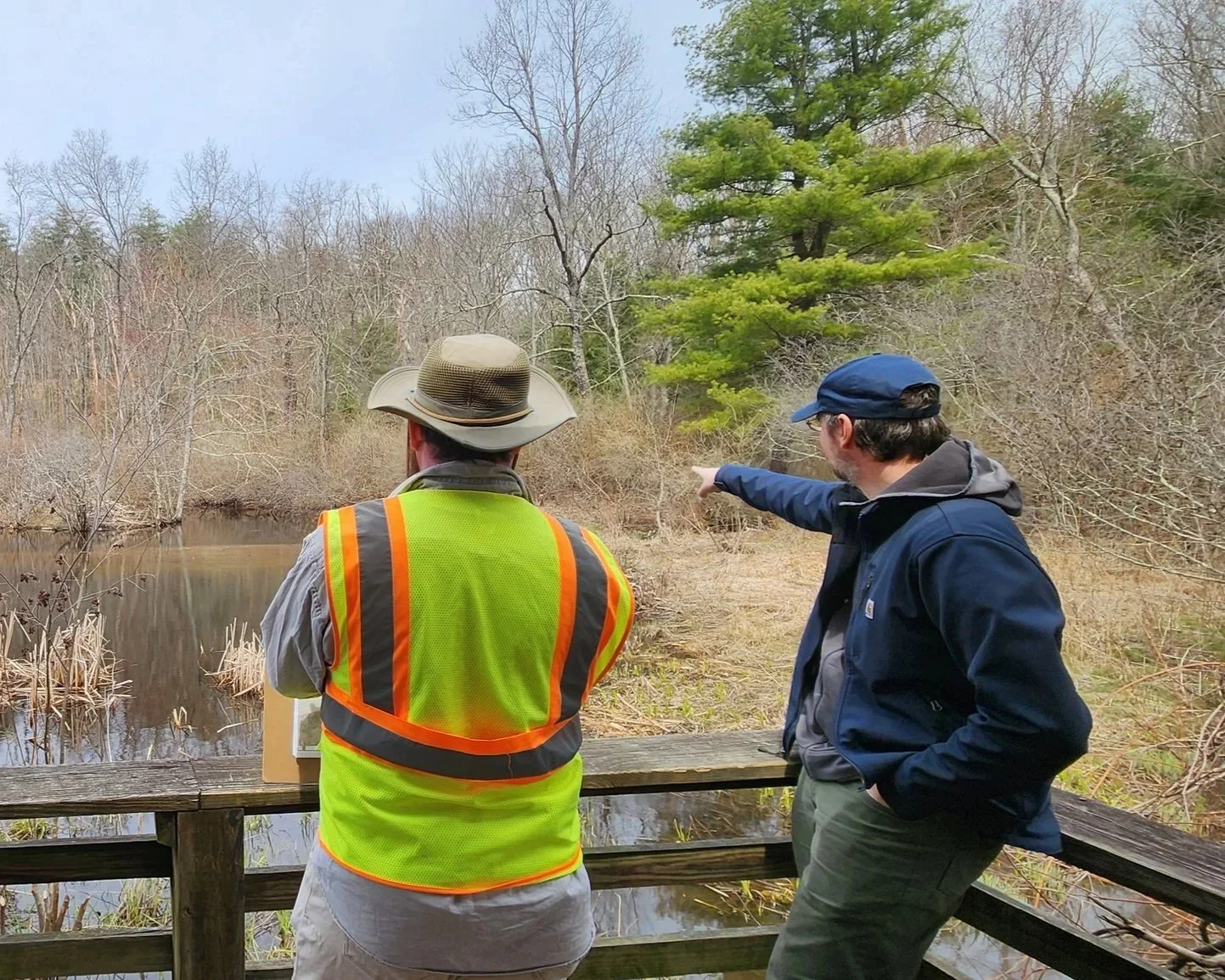
We work together with our clients to analyze how existing site conditions relate to their specific project goals and needs in order to make data informed decisions.
GPS Surveying
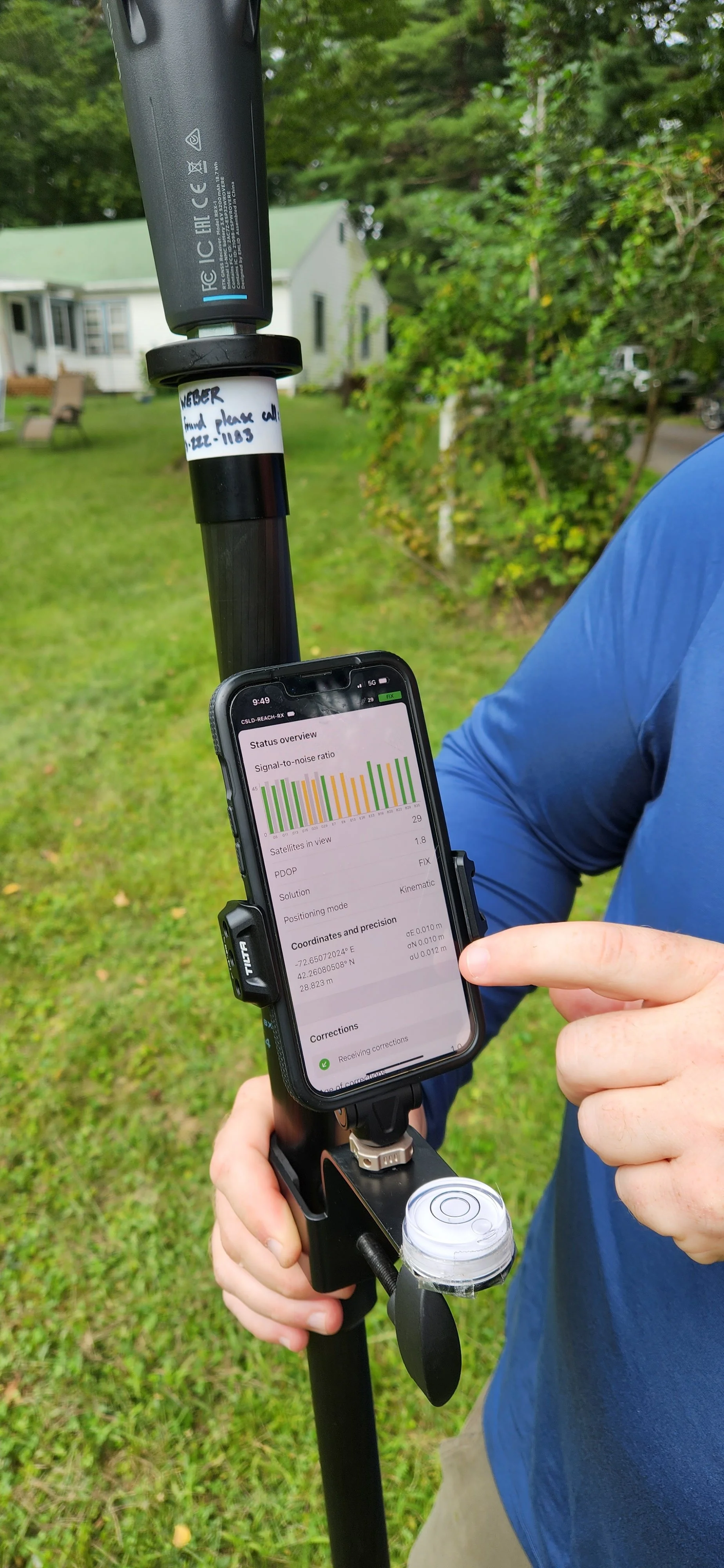
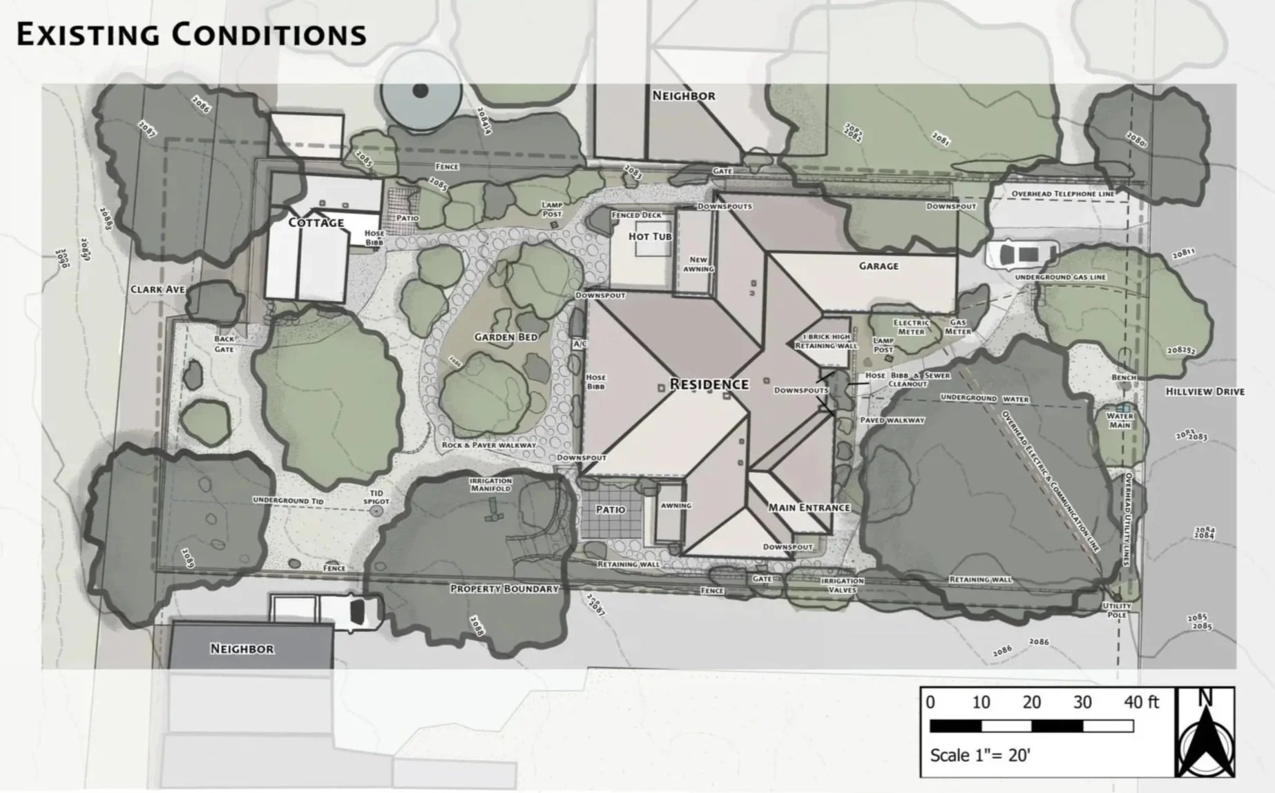
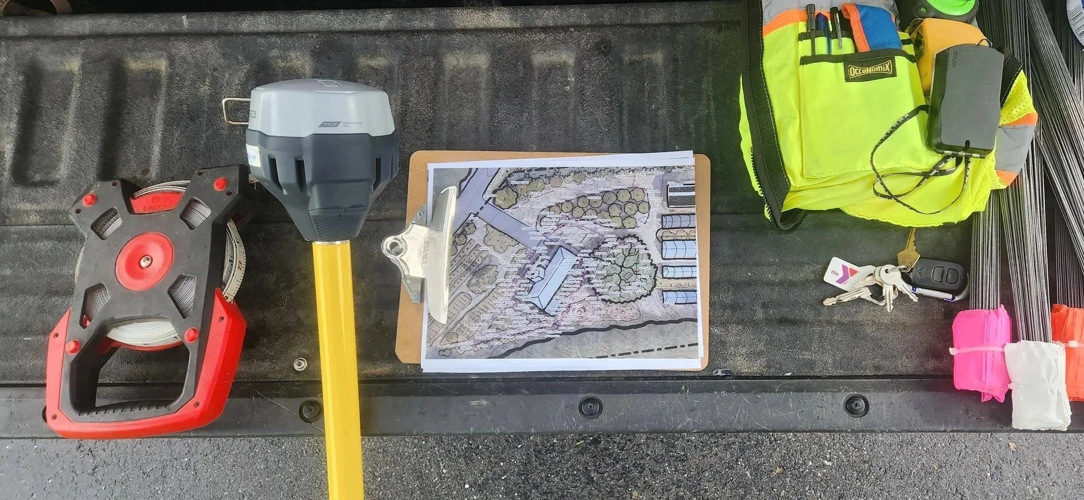
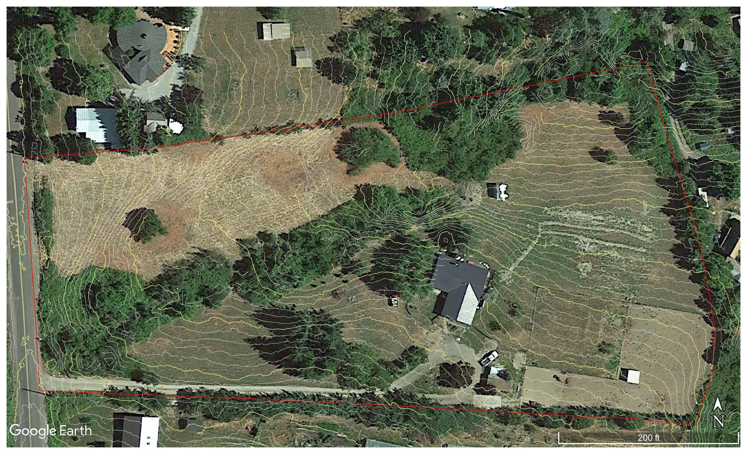
Onsite observation and precision level data collection allows us to document existing site conditions accurately. This includes structures, topography, vegetation, utilities, property boundaries and more. Combined with LIDAR data, this information allows us to create highly accurate georeferenced base maps of your site, to be used for documentation, design, project planning and layout.
Drone Mapping
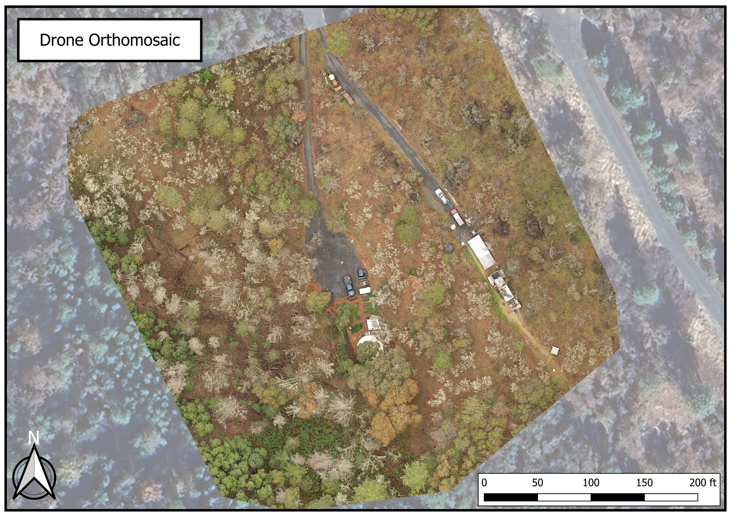
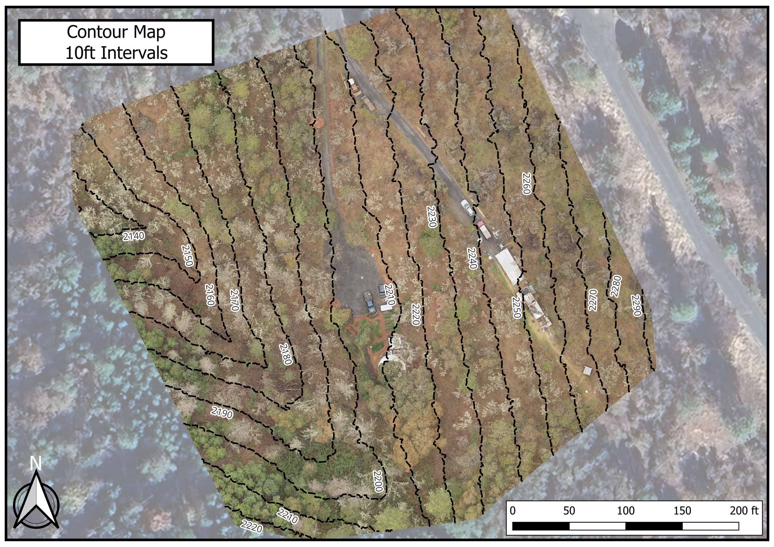
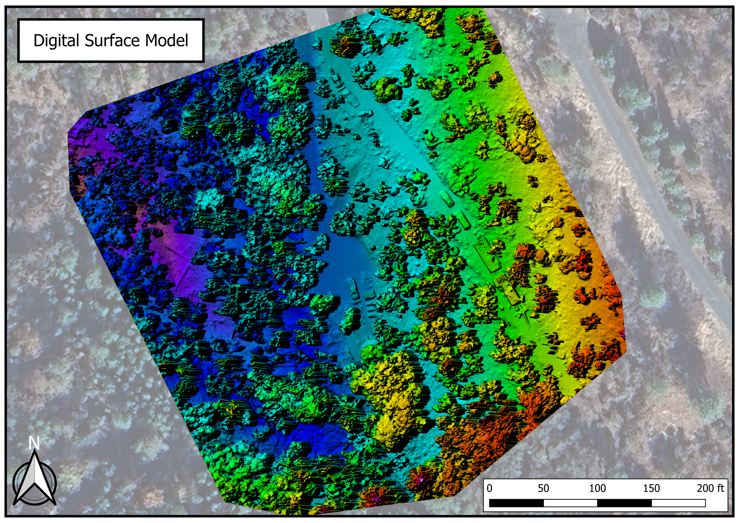
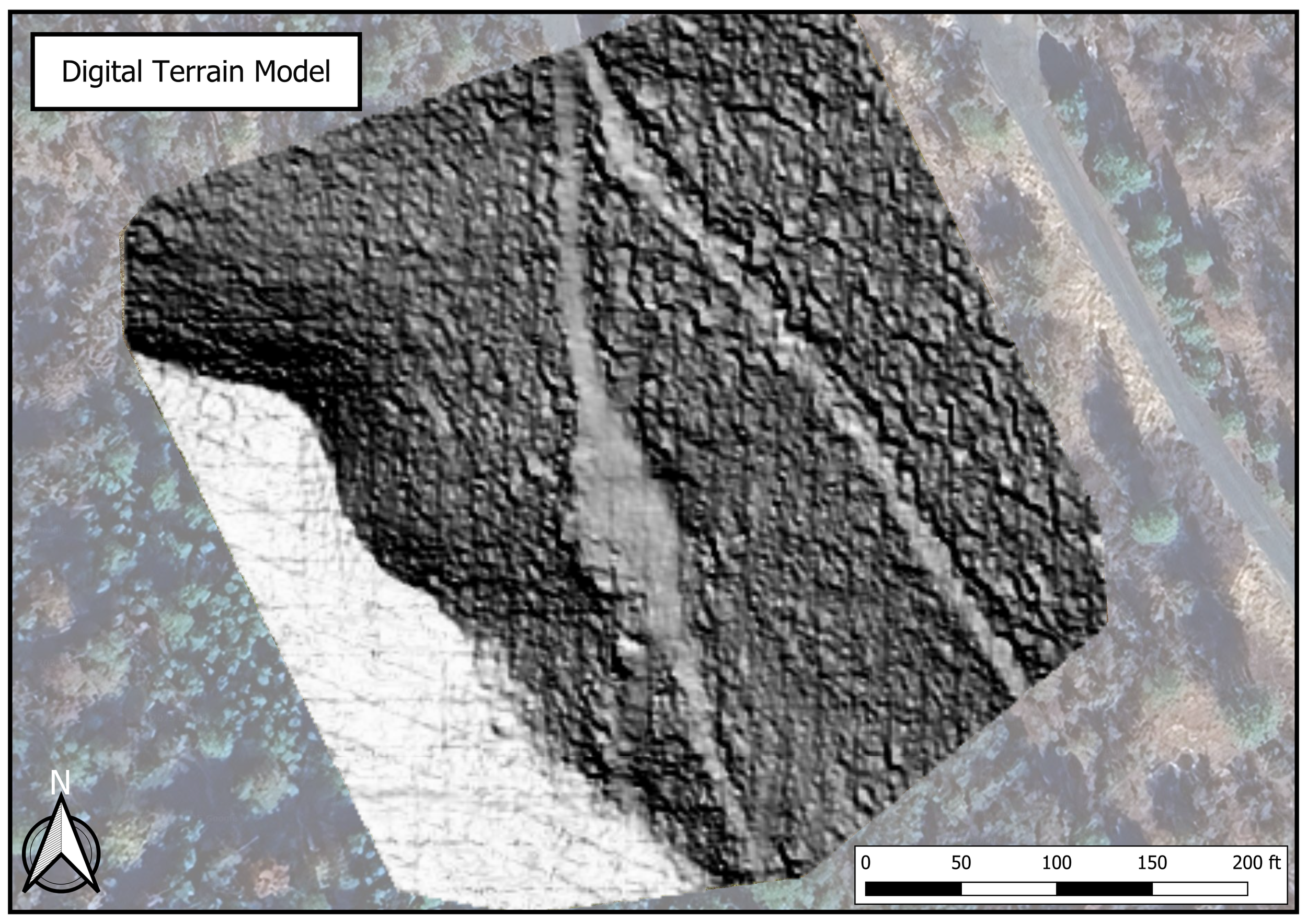
Drone UAS (Unmanned Aircraft Systems) allow precision mapping and surveying of your site. Deliverables include high-resolution orthomosaic imagery and digital elevation models. These can be used for accurate 2D mapping and 3-D modeling, allowing efficient site analysis and project planning. Output files can be printed as large format scaled maps or uploaded for viewing and processing in Google Earth Pro and GIS software. Whether you are looking for a standalone scaled aerial map to better understand your land's potential, or need a foundational survey map to kick off a comprehensive master plan, our drone mapping services provide the bird's-eye clarity required to accurately plan your project
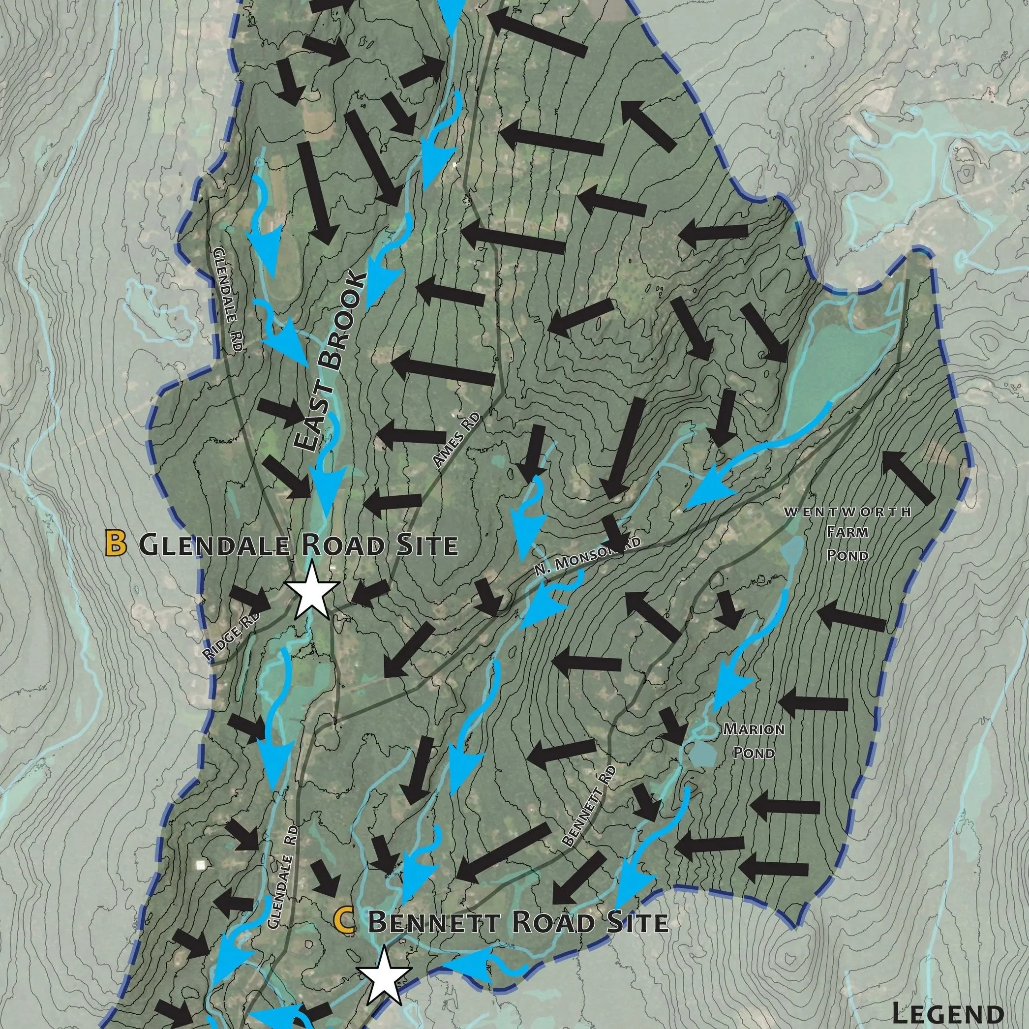
GIS Analysis
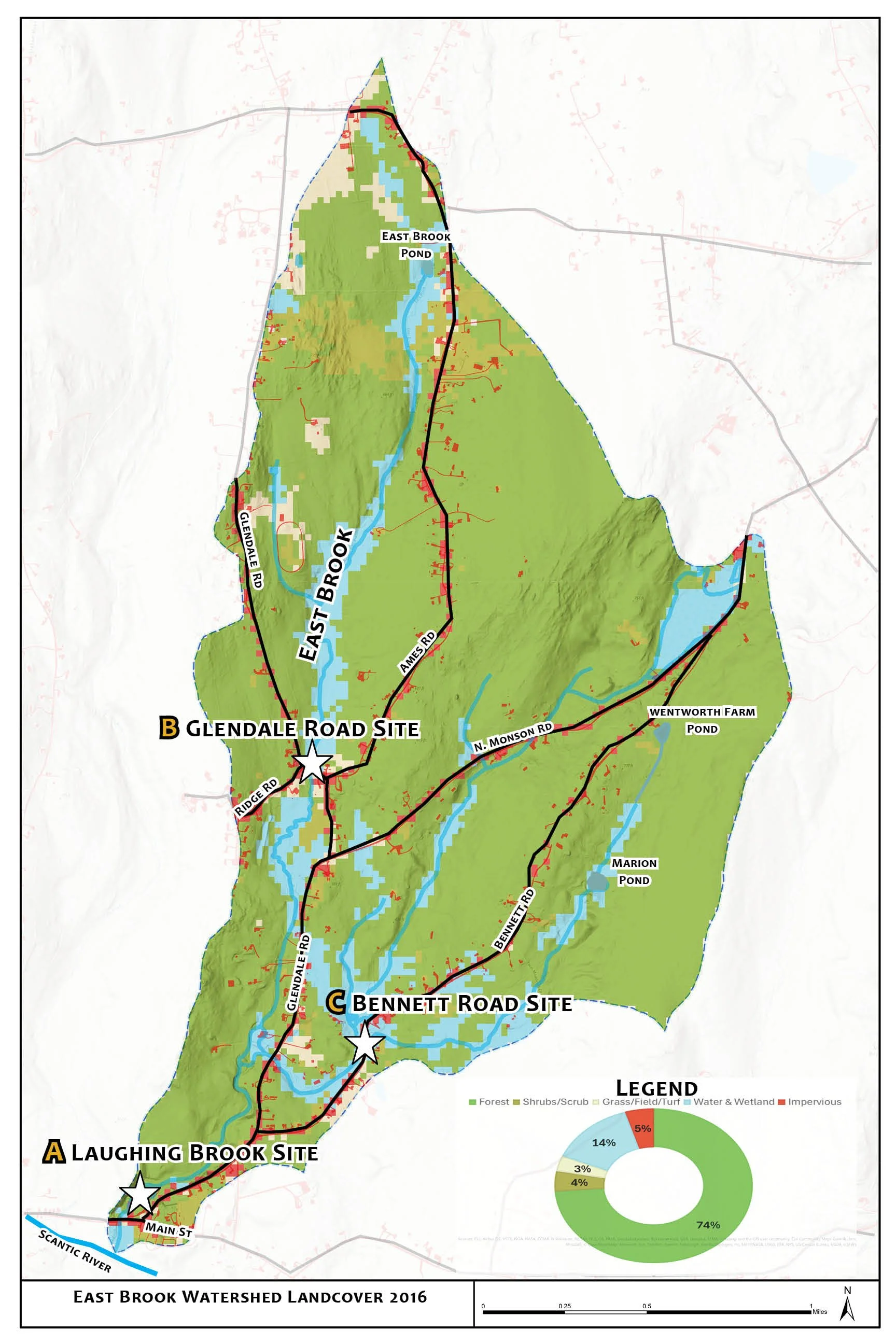
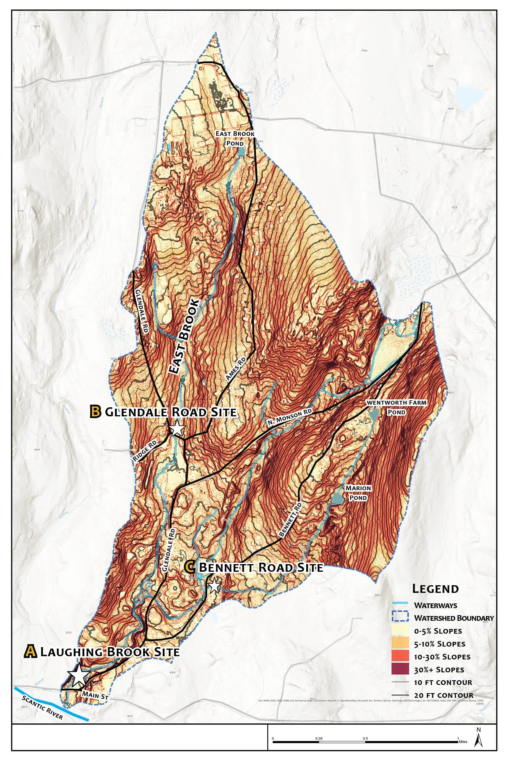
Utilizing Geographic Information Systems (GIS) we are able to integrate diverse layers of data such as satellite imagery, landcover, landuse, lidar, street networks, development, and demographic statistics—into a single digital framework to reveal hidden patterns and spatial relationships. Whether we are developing a whole watershed-scale plan to implement green stormwater infrastructure, restoring the native habitat of an oak woodland, or engineering resilient water solutions for a half-acre backyard, GIS provides the exact data required to make highly informed, data-driven decisions for strategic planning.
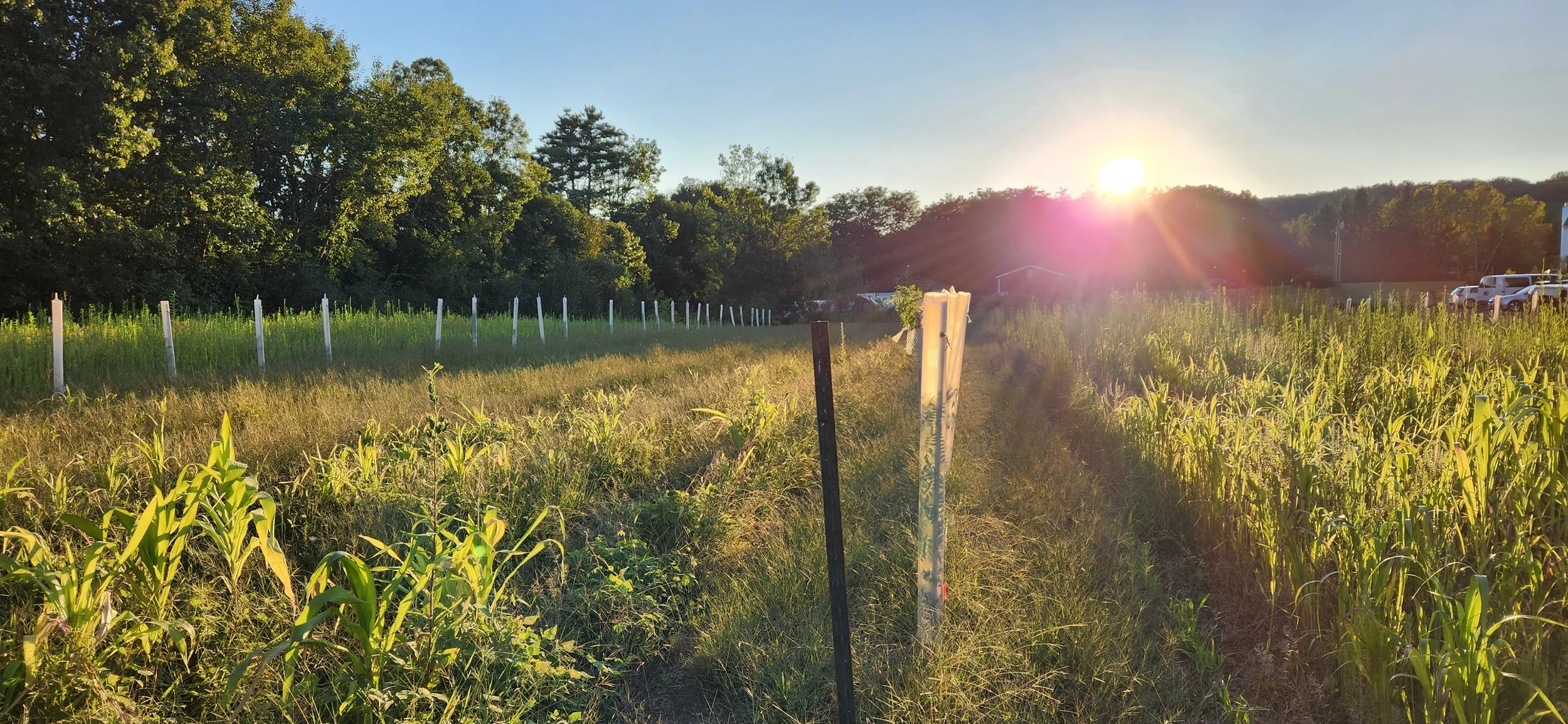
Ecological Planning
Ranging from individual site-scale stewardship planning for small properties and homesteads to large scale ecosystem restoration projects and whole-watershed scale master planning, we create comprehensive, long-term strategic plans that showcase the ecological site conditions, social context and environmental issues in a project area, offering actionable, prioritized strategies and solutions for infrastructure , land use, natural resource management and native habitat restoration
Relevant past projects: